Buckfastleigh has two moorland rivers flowing through it, the Mardle and the Dean Burn, which converge near the bridge at Station Road. With the increasing frequency of torrential rain causing rivers to rise very fast, flooding is a constant worry for those living nearby. But since November 2012, when a serious flood left many houses in that area badly damaged, a lot has been done in Buckfastleigh to address this problem.
After the 2012 flood, a group of residents and Town Councillors began to work on a flood plan for the town. Grants were secured to purchase equipment and to fit flood defences to houses near the river. An emergency plan was developed and a Volunteer Emergency Response Team put together and trained. The Buckfastleigh Flood Group Facebook was set up in 2014 and now has 510 members who can be warned of rising river levels in time to get out their flood gates or sandbags, and be prepared to join in the community response if needed.
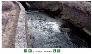
A key element of this warning system is the Flood Gauge and Camera. It allows members of the Town Flood Team to remotely monitor river levels and also to see the state of the river at Station Road during periods of heavy rain and high river levels. If the river is rising fast, text alerts are sent automatically to the team, enabling them to notify residents. This system has unfortunately not been working for some time but at their last meeting, the Town Council agreed to cover half the costs to replace and upgrade the camera, the remainder being matched by a grant from Devon County Council’s funds for projects like this. Engineers have recently installed a new camera and it’s working perfectly.
“With the repair of the Buckfastleigh Flood Gauge, we have restored the ability to monitor the river levels in all conditions”, commented Councillor David Patrick. “That will allow us to be ready for the next event. Early warning using this tool will ensure that we can help residents to keep their homes and contents protected. As Climate Change continues to affect us, we could see an increase in river levels and heavy rain storms – this tool allows us to be ready for when that happens”

Tackling flooding requires a two-pronged approach: as well as putting measures in place to ensure rising water levels do as little damage as possible, one needs to take steps to reduce the flow of water. This more long-term issue of flood management is another important part of the Council’s determination to keep the town’s residents safe and dry.
After many discussions between the Council and the Environment Agency, the Mardle and Dean Burn catchment areas were selected to be part of an exciting project, Upstream Thinking, which seeks to manage river flow by working with natural processes. This involves repairing existing river banks, restoring woodlands, building ‘leaky dams’, and improving soil quality and flood plains with the aim of slowing down the water and giving it time to soak into the ground rather than filling our rivers with fast flowing, silt filled run-off. Buckfastleigh and the River Mardle were selected as the terrain is a good match for many other parts of Dartmoor, and will provide useful data. It’s a groundbreaking project and will, in the future, hopefully mean that the state of the art Flood Gauge on the Mardle rarely has to send out an alert.
